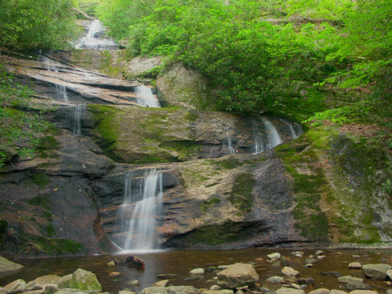
Setrock Creek Falls is an 85-foot tiered waterfall on Setrock Creek in Pisgah National Forest, Yancey County, North Carolina, near Black Mountain Campground at the foot of Mount Mitchell. The trail to it has been closed since Hurricane Helene damaged the campground and the falls area in 2024.
The falls
Setrock Creek, a small tributary of the South Toe River, steps down four tiers of horsetails and slides, and the water clings to the rock before ending in a pool. Lidar data measured about 85 feet; older surveys put it at 55 feet. Guidebook figures run from 50 to 75 feet, and some sources count six drops.
Getting there
The falls are closed. The Forest Service lists the trail as temporarily closed for storm damage, and, as of August 2026, the trailhead and Black Mountain Campground were still shut after Helene. No reopening date has been announced.
Before the storm, access was by South Toe River Road (Forest Road 472), reached 2.2 miles north of the Blue Ridge Parkway on NC 80; the road turns to gravel before the campground. Trail #197 is an easy spur of 0.2 mile each way from the Briar Bottom Bicycle Trail, with 80 feet of elevation change. Measured from the campground parking, distance estimates range from 1 mile to 1.4 miles round trip.
When to go
Flow depends on recent rain. In dry weather the creek can drop to a trickle, so the falls look best after a wet spell.
On site
The trail ends at a clearing at the base of the falls, with a pool below the last tier.
Nearby
Upper Setrock Creek Falls is about 0.6 mile upstream. Roaring Fork Falls is 2.1 miles away and Mitchell Falls 3.6 miles.
Distances are straight-line.