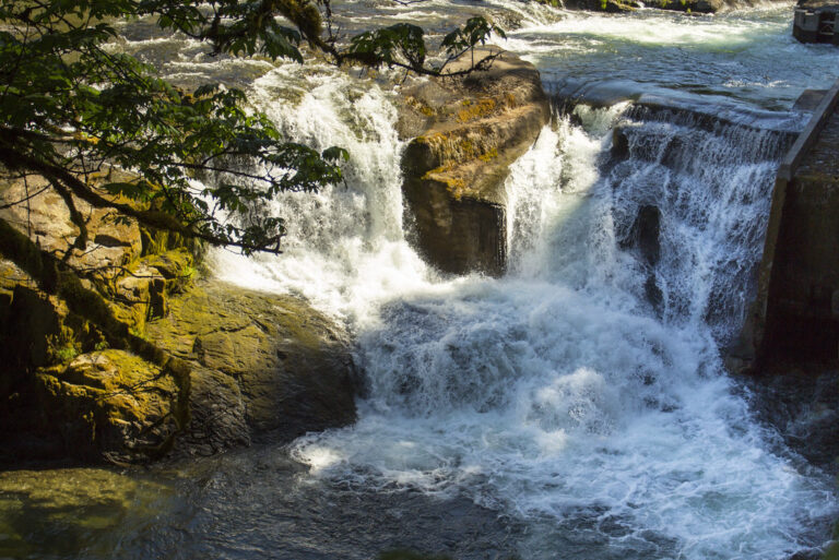
Steamboat Falls is a 20-foot wide horsetail waterfall on Steamboat Creek in the Umpqua National Forest, Douglas County, Oregon. It sits beside a small campground north of Highway 138, and a fish ladder next to it lets steelhead get past the drop.
The falls
Steamboat Creek slides about 35 feet wide over a steep ledge in a single drop, surveyed in person. A USFS waterfall brochure gives 25 feet. The fish ladder beside the falls draws off most of the creek, so in summer the falls themselves can carry little water; at high water the creek runs up to 200 cubic feet per second.
Getting there
From Roseburg, drive 38.5 miles east on Highway 138 to Steamboat Creek Road (Forest Road 38), then 5.3 miles up it and right onto Forest Road 3810 to Steamboat Falls Campground. A fenced overlook stands about 50 feet from the parking area near campsite 5; the approach is easy. The campground has nine first-come sites, open year-round, and a day-use area with picnic tables. Payment is by Recreation.gov Scan & Pay on site.
When to go
The falls are impressive in winter and much reduced by May. For fish, May through July is when steelhead can be watched trying to leap the falls.
On site
Swimming at the falls is available in summer, and cliff jumping and sunbathing on the rock slabs are also done here. There is no drinking water, trash service or cell coverage, so bring water and pack out trash. Dogs must be leashed. Steamboat Creek is closed to all fishing.
History and name
The name ties to mining slang: claims that failed were said to have been "steamboated."
Nearby
Steelhead Falls is about 2.9 miles away, Little Falls, also on Steamboat Creek, about 4.1 miles, and Jack Falls about 4.6 miles. The Mott segment of the North Umpqua Trail starts about 6 miles southwest of the campground.
Distances are straight-line.