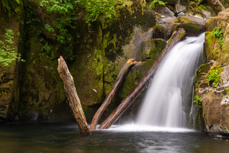
Sweet Creek Falls is a 70-foot tiered waterfall on Sweet Creek in the Siuslaw National Forest of Lane County, Oregon, south of Mapleton in the Coast Range. The creek steps down through four tiers inside a narrow, mossy canyon, and the Sweet Creek Trail reaches it past a string of smaller falls.
The falls
The World Waterfall Database, which surveyed the falls in person, breaks the 70 feet into a 10-foot punchbowl at the top, a 30-foot horsetail, and two 15-foot drops into a pool. Bends in the canyon hide parts of the falls from any single spot: the upper punchbowl can only be seen from above and is hard to photograph, while the main trail gives close views of the 30-foot horsetail.
Getting there
From the Siuslaw River bridge in Mapleton, leave Highway 126 and drive 11 miles south on Sweet Creek Road. Sweet Creek Trail #1319 runs 2.2 miles along the creek and has four trailheads: Homestead, Sweet Creek Falls, Wagon Road and Beaver Creek Falls. The Homestead Trailhead, where the vault toilet is, has been closed since 2025 because the boardwalk on the first segment is out, so use the second one, the Sweet Creek Falls Trailhead. The walk from there is 0.8 mile round trip with about 350 feet of gain, on an uneven path of roots, rocks and steps. There is no fee or permit, and the trail is open year-round.
When to go
Winter and spring are the recommended seasons for flow.
On site
The trail uses wooden bridges and a catwalk bolted along the canyon wall. Leashed dogs are allowed, though some dogs are uncomfortable on the catwalk. Mossy rocks are slippery and the current is fast, so stay on the trail near the water. A less-used trail on the opposite bank gives views of the larger tiers.
History and name
The falls take their name from the creek, named for homesteaders Cecil C. Sweet and Zara T. Sweet, who settled near its mouth.
Nearby
Several other falls sit on the same stretch of Sweet Creek: Elk Wallow Falls is about 0.4 mile away, Punchbowl Canyon Falls about 0.6 mile and Homestead Falls about 0.7 mile. Beaver Creek Falls, about 0.6 mile away, has its own trailhead on the same trail system.
Distances are straight-line.