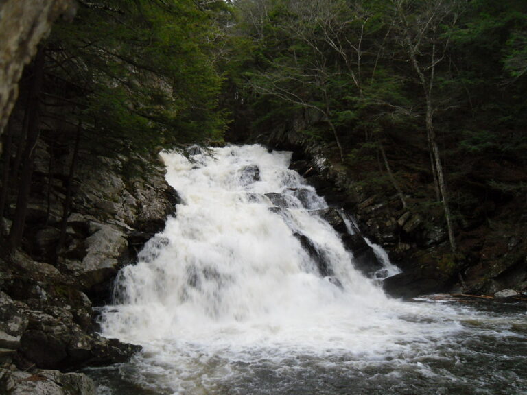
Wahconah Falls is a 65-foot tiered waterfall on Wahconah Falls Brook in Wahconah Falls State Park, a 48-acre Massachusetts state park in Dalton, Berkshire County. The brook steps down over Becket Gneiss in a chain of small drops that ends in a broad 40-foot cascade, a few hundred feet from a free parking lot.
The falls
A survey in person describes three main tiers totaling 65 feet: two back-to-back, nearly vertical plunges of about 13 feet together, then a broad lower cascade of about 40 feet that ends in a large pool. A few minor drops of 2 to 4 feet sit upstream. The falls are about 15 feet wide on average and up to 50 feet at their widest. Earlier surveys listed 55 feet. The brook flows out of Windsor Reservoir upstream.
Getting there
The park is at 68 Wahconah Falls Road in Dalton and is open sunrise to dusk; parking is free. From the Route 9/8A junction in Dalton: 2.3 miles east, then right on Wahconah Falls Road for under half a mile to the lot, with the falls within 500 feet. A half-mile loop past the upper falls is the main route. An out-and-back of 0.9 mile with about 156 feet of gain, mostly downhill on the way in, is rated moderate.
When to go
Spring runoff brings the best flow; March to June is peak season, with about 5 cubic feet per second in the wetter eight months and about 1 in the other four. The falls get busy in summer and on fine days.
On site
Swimming is prohibited. Activities include hiking, fishing, picnicking and wading. Dogs are allowed. The trails are graded; there is no documented wheelchair route to the falls.
History and name
The falls are said to be named for Wahconah, daughter of Chief Miahcoma. The Wahconah and Nessacus legend first appears in an 1879 travel guide by Pittsfield historian J.E.A. Smith, and its Indigenous origin is questioned; the name Wahconah was already on a Pittsfield paper mill in 1868.
Nearby
Pettibone Falls is about 5.8 miles away, Windsor Jambs Falls about 6.7 miles, Lulu Cascade about 9.4 miles and Tannery Falls about 11 miles.
Distances are straight-line.