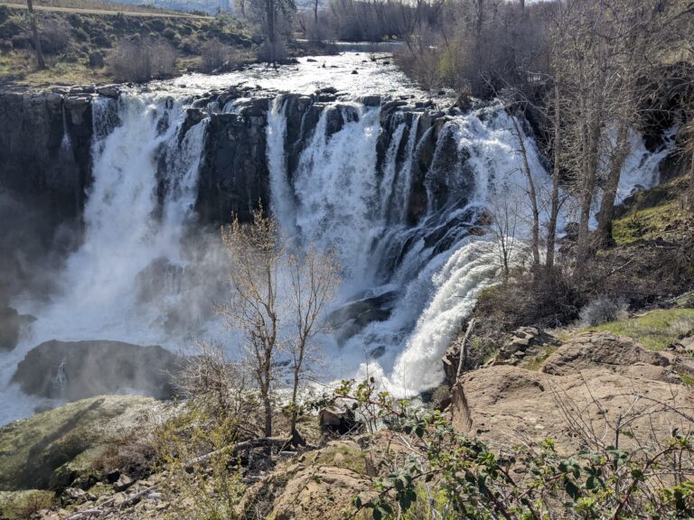
White River Falls is a 75-foot segmented horsetail waterfall on the White River in Wasco County, Oregon, in White River Falls State Park near Tygh Valley. The river spreads across a broad basalt ledge and breaks into several separate strands, beside the remains of one of Oregon's first hydroelectric plants.
The falls
A survey gives a single 75-foot drop over a horseshoe-shaped ledge in the basalt. At normal flow the water splits into three to six segments across a width of about 190 feet; at peak spring runoff the whole ledge can go under, widening the falls to about 260 feet. Oregon State Parks gives the height as 90 feet. The White River is fed partly by Mount Hood glaciers, and their silt can turn it milky in late summer and early autumn.
Upstream, a diversion built for the old power plant takes most of the river, and in the dry season much of the visible face of the falls runs thin. The falls were long treated as two tiers under the name Tygh Valley Falls. In 2014 the Oregon Board of Geographic Names split off the lower step, about 180 feet downstream, as Celestial Falls.
Getting there
The parking area sits 0.1 mile off Highway 216 on a paved access road. Oregon State Parks charges no day-use fee and keeps the park open all year for day use. The gravel lots are small and not recommended for vehicles over 24 feet. From November 1 to mid-March the main lot and flush restrooms close and the gate is shut, so winter visitors walk in; portable toilets are provided then.
A flat gravel path leads a short way to the overlook. A steep, rocky route of 0.7 mile with about 150 feet of elevation change drops into the canyon.
When to go
Spring brings the strongest flow; by autumn the falls can shrink to a trickle. The canyon has little shade and the rock walls radiate heat in summer.
On site
Swimming is not recommended because the currents are deadly and unpredictable. Standing or climbing on cliff edges and the historic structures is prohibited. Kayaking is not allowed. In July 2012 a 15-year-old and a 26-year-old drowned after falling while trying to climb behind the falls for a photo. Carry about 20 ounces of water per person per hour. Dogs are allowed on leash.
History and name
Pacific Power and Light ran the park's hydroelectric plant from 1910 to 1963. Its historic structures remain in the park and are off limits to climbing.
Nearby
Celestial Falls, the former lower tier, is just below the main drop, and Lower White River Falls is about 0.2 mile downstream. Sherars Falls, the tribal salmon fishery on the Deschutes River, is about 3.1 miles away. The Dalles is about 24.6 miles to the north.
Distances are straight-line.