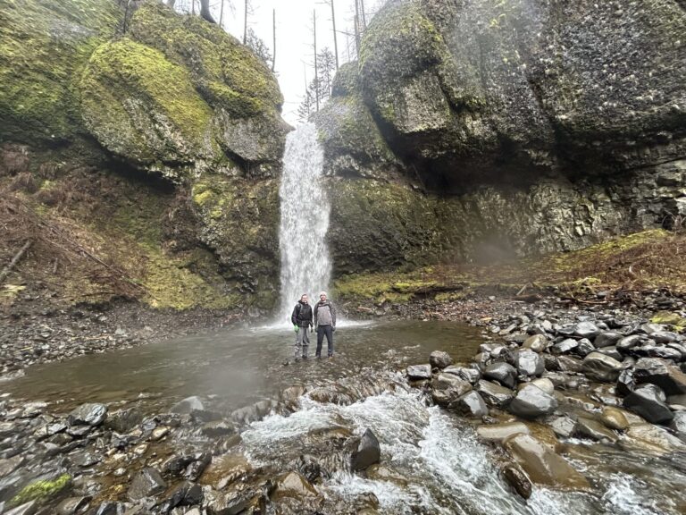
Wahe Falls is a 75-foot plunge waterfall on Moffett Creek in the Columbia River Gorge of Multnomah County, Oregon, about 5.1 miles southwest of Cascade Locks. It is the last of nearly a dozen waterfalls on the creek and has no developed trail.
The falls
Moffett Creek drops in a single free-falling plunge, about 10 feet wide, into an amphitheater of basalt. In-person surveys list 75 feet; earlier surveys recorded 80 feet. Flow averages around 30 cubic feet per second for eight months of the year, falling to about 5 in the dry months.
Getting there
There is no developed or officially sanctioned route, making the approach a difficult bushwhack. The way in leaves Gorge Trail 400 near Munra Point and follows Moffett Creek upstream past several short, steep falls; the creek's mouth lies in the John B. Yeon State Scenic Corridor.
When to go
Winter through spring provides the strongest flow.
On site
The base shows heavy flash-flood damage, with a scoured streambed and fallen trees. Going beyond the falls to the upstream cascades takes technical canyoneering skills. In spring, yellow fawn lilies grow on the large boulders above the falls.
History and name
The name Wahe appears in records dating back to at least 1916, in the Mazamas mountaineering club's journal and Oregon water-resource files; its meaning is unknown. A USGS mapping error spread the names Moffett Falls and Moffett Creek Falls.
Nearby
Upper Wahe Falls is about 0.2 miles upstream, Apocalypse Falls about 0.7 miles, and Wahclella Falls, on neighboring Tanner Creek, about 0.8 miles.
Distances are straight-line.