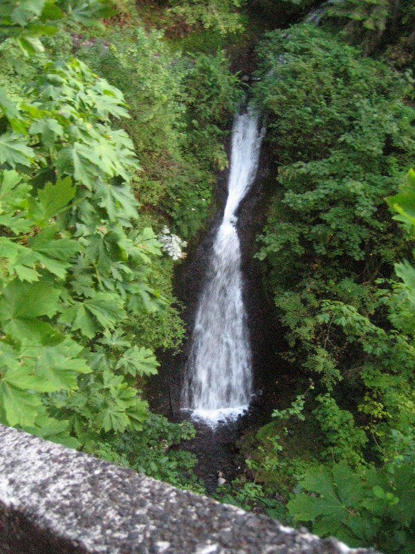
Shepperds Dell Falls is a 220-foot tiered horsetail waterfall on Youngs Creek in Shepperd's Dell State Natural Area, Multnomah County, Oregon. It twists down a narrow basalt alcove directly beneath one of the arch bridges of the Historic Columbia River Highway, and a short stepped path leads from the road to its lower falls.
The falls
The World Waterfall Database, which surveyed the falls in person, counts eight drops over 220 feet, the tallest 90 feet. Youngs Creek turns sharply and cascades about 32 feet over small steps, then funnels into a 45-foot veil, forming a horsetail feeding a plunge. Two final drops of about 20 feet each run beneath the bridge. Much of the series is hidden from the road; what visitors see from the trail is an upper fall of about 42 feet and a lower tier of about 50 feet.
Getting there
The falls sit on the Historic Columbia River Highway about 4 miles east of Crown Point. Eastbound drivers take I-84 exit 28 (Bridal Veil), go up Bridal Veil Road and then 1.6 miles west on the Historic Highway; westbound, take exit 35 (Ainsworth) and drive 8.9 miles west. Parking is available on both sides of the highway. No pass is required.
From the road a path of 0.2 mile round trip, with short stairs, drops to a viewpoint beside the lower falls. The easy route was cut into the basalt cliffs when the highway was built.
When to go
The site is open for day use all year, with no overnight stays. Winter and spring bring the strongest flow; at low water the creek can run dry.
On site
There is no restroom at the trailhead, and dogs must be leashed. Hikers should stay on the trail and clean their boots to avoid spreading invasive seeds. Ash firewood is banned under an emerald ash borer quarantine.
History and name
In 1915 George Shepperd gave the property, all that he had, to the City of Portland in memory of his wife Mattie; the city later handed it to the state, managed today by Oregon State Parks. The arch bridge over the 100-foot-wide canyon dates from 1914 and was the second bridge built on the Historic Highway, designed by K.P. Billner.
Nearby
Bridal Veil Falls is about 1 mile away, with Upper Bridal Veil Falls and Latourell Falls each about 1.2 miles and Upper Latourell Falls about 1.6 miles.
Distances are straight-line.