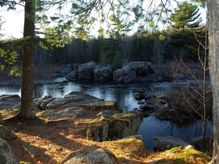
Grandfather Falls is a long run of rapids and cascades on the Wisconsin River in Lincoln County, Wisconsin, about 10 miles northwest of Merrill. The total drop reaches about 89 feet over roughly a mile; the rapids once stalled log drives and now feed a hydroelectric facility operated by Wisconsin Public Service.
The falls
The river flows over dark Precambrian igneous bedrock below Grandfather Dam in a string of ledges and boulder rapids rather than a single plunge. The river descends roughly 60 feet over about 0.8 mile; it is not counted as a true waterfall. Most of the river is normally diverted through a canal on the east bank and penstocks to a powerhouse about a mile downstream, so the natural channel carries much less water outside spring spills and scheduled releases.
Getting there
Access is at Grandfather Dam, off WI-107 about 12 miles north of Merrill, where a federal hydropower assessment describes a gravel lot for about 15 cars and a gently sloped, hard-surfaced fishing pier. A segment of the Ice Age Trail, 4.8 miles one way, runs between Grandfather Dam and Camp New Wood County Park and is open to hiking, skiing and snowshoeing.
When to go
Spring brings the most water over the falls. Wisconsin Public Service schedules whitewater releases into the bypassed channel; in 2026 they were set for May 9, May 16 and May 30, at 1,500 to 1,800 cfs from about 10 a.m. to 2 p.m., with updates posted by noon the day before.
On site
The riverbed consists of rugged boulders and open bedrock. The main ledge is rated Class IV to V+ at every flow, with a hole that recirculates powerfully at high water; paddlers should take out above it and scout. A primitive portage trail of about 500 feet skirts the dam, and the powerhouse area is fenced.
History and name
The Ojibwe called the falls Konajewun, "long falls." Voyageurs from John Baptiste DuBay's trading post named the rapids upstream in sequence, ending with Taureau Grand-père, or Grandfather Bull; the falls were also known as Boileaux Rapids. In 1880 Peter B. Champagne built a flushing dam and sawmill here, and a small village grew around it. The falls held the largest log jam in Wisconsin history, some 80,000,000 board feet. Wisconsin Public Service began the hydro project in 1938; its two generators produce about 17 megawatts.
Nearby
Spirit Falls on the Spirit River is about 13.7 miles away, and The Dells of the Eau Claire is about 30.2 miles away. Camp New Wood County Park, a few miles south, has primitive camping and river fishing.
Distances are straight-line.