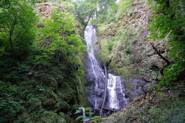
Coopey Falls is a 150-foot horsetail waterfall on Coopey Creek in the Columbia River Gorge, Multnomah County, Oregon. It pours off the gorge wall about a mile east of Bridal Veil Falls, directly behind a convent, and hikers on the Angels Rest Trail pass a view of it on their way up.
The falls
The spring-fed creek slides down a single steep drop, keeping contact with the rock as it falls. Height measurements generally cite 150 feet with an average width of about 10 feet, though some hiking descriptions place it as a 175-foot horsetail. Flow ranges from about 20 cubic feet per second at its peak down to none.
Getting there
The base of the falls sits on private grounds of the Franciscan Sisters of the Eucharist, off the Historic Columbia River Highway. A path of about 100 feet leads from the convent parking lot to the falls; visitors should ask permission at the convent before walking in.
The public alternative is the Angels Rest Trail. Its trailhead sits at the junction of the Historic Columbia River Highway and East Bridal Veil Road, about half a mile west of the convent, reached from I-84 exit 28 from Portland or exit 35 from Cascade Locks. The trail climbs a little over half a mile to an overlook near the top of Coopey Falls; the full hike to the Angels Rest bluff covers 4.8 miles round trip with 1,500 feet of gain, rated moderate. Since March 30, 2026, parking at the Angels Rest Trailhead requires an Oregon State Parks day-use permit: $10 for Oregon residents, $12 for nonresidents, bought online or by QR code; a 12- or 24-month state parks permit or a current state park camping hangtag also works.
When to go
Winter through spring offers the strongest flow, which drops to almost nothing in the dry season. The Angels Rest Trail sees high visitor traffic, situated less than an hour from Portland and Vancouver.
On site
From the trail the falls are seen from above. Above the Coopey Falls viewpoint, the route switchbacks for 1.6 miles through the burn of a 1991 fire to an exposed bluff with long drops; keep children close near the edge.
History and name
The falls and creek are named for Charles Coopey, an English tailor who once owned the neighboring land. He hoped to use water from Wahkeena Falls to run a woolen mill, and later sold Wahkeena Falls to Simon Benson.
Nearby
Upper Coopey Falls is about 0.1 mile upstream. Foxglove Falls is about 0.8 mile away, and Bridal Veil Falls about 0.9 mile.
Distances are straight-line.