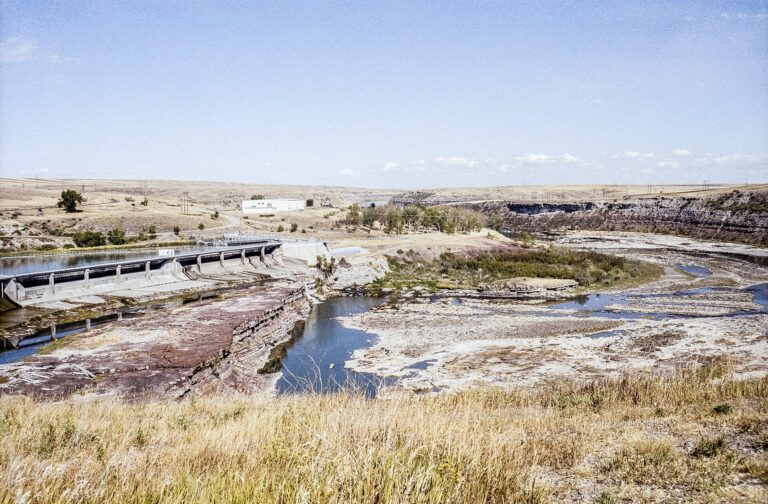
Rainbow Falls is a 44-foot waterfall on the Missouri River in Great Falls, Montana, forming a sheet of water about 1,000 feet wide that pours over a sandstone ledge just below Rainbow Dam. It is the second of the five Great Falls of the Missouri, situated just upstream of Crooked Falls.
The falls
The river drops over a single straight ledge of Kootenai Formation sandstone, with a railroad bridge crossing directly above the brink. The drop measures 44 feet, with width estimates ranging from 1,000 to 1,320 feet. Rainbow Dam sits atop the falls and diverts most of the river through penstocks to its powerhouse, utilizing the combined drop of more than 70 feet at Rainbow and Crooked Falls. Rainbow and Crooked Falls remain the two among the five that stay closest to their natural state.
Getting there
The Rainbow Falls Scenic Overlook is a pullout on the left side of Giant Springs Road at 6401 Giant Springs Road, accessible by vehicle or on foot. The falls lie within Giant Springs State Park, open all year from sunrise to sunset. Nonresidents pay $8 per vehicle or $4 on foot, by bike or by bus; Montana residents who paid the $9 state parks fee with vehicle registration pay no day fee. Paved and dirt sections of the River's Edge Trail run along the river here.
When to go
Flow depends on dam operations. In spring, at peak runoff, the falls come closest to their original form; by autumn most water is diverted and the flow shrinks to a trickle.
On site
The overlook provides views of the falls and Rainbow Dam. Pets are allowed in Giant Springs State Park, which offers restrooms, picnic shelters and accessible facilities. A route to the base is not documented.
History and name
Meriwether Lewis reached the falls on June 14, 1805, describing a cascade of about fifty feet falling in one even sheet; the expedition called it Handsome Falls, and it was also known as Beautiful Cascade. Railroad engineer Thomas Paschall Roberts renamed it Rainbow Falls in 1872 for rainbows in the spray. Rainbow Dam dates to 1910, and the falls are listed as a High Potential Historic Site on the Lewis and Clark National Historic Trail. The Lewis and Clark Interpretive Center is 1.5 miles west, and Giant Springs about one mile upstream.
Nearby
Crooked Falls, reached by hiking the River's Edge Trail, is about 0.4 miles downstream. Colter Falls, about 0.5 miles away, is now submerged, and Black Eagle Falls is about 2.8 miles upstream.
Distances are straight-line.