Waterfalls in San Bernardino County, California
16 waterfalls in San Bernardino County, California, near Anaheim. The tallest is Big Falls at 400 ft. All waterfalls in California.
State: California 47
- Alabama 97
- Arizona 66
- Arkansas 280
- California 1,039
- Colorado 345
- Connecticut 79
- Florida 3
- Georgia 298
- Idaho 249
- Illinois 20
- Indiana 24
- Iowa 8
- Kansas 24
- Kentucky 65
- Louisiana 6
- Maine 175
- Maryland 13
- Massachusetts 37
- Michigan 294
- Minnesota 43
- Mississippi 8
- Missouri 11
- Montana 252
- Nebraska 14
- Nevada 25
- New Hampshire 264
- New Jersey 5
- New Mexico 20
- New York 879
- North Carolina 495
- North Dakota 1
- Ohio 26
- Oklahoma 30
- Oregon 1,342
- Pennsylvania 274
- Rhode Island 5
- South Carolina 22
- South Dakota 10
- Tennessee 427
- Texas 71
- Utah 76
- Vermont 229
- Virginia 127
- Washington 2,596
- West Virginia 13
- Wisconsin 83
- Wyoming 267
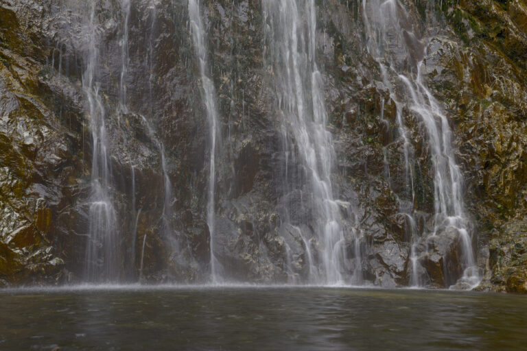
San Bernardino County, California
355 fttotal height
- Tallest drop 145 ft · 4 drops
- 10 mi from Rancho Cucamonga

San Bernardino County, California
190 fttotal height
- On Lytle Creek
- 8 mi from San Antonio Heights
San Bernardino County, California
150 fttotal height
- On Monkeyface Creek
- 7 mi from Yucaipa
San Bernardino County, California
50 fttotal height
- On East Fork Mountain Home Creek
- 7 mi from Yucaipa
San Bernardino County, California
25 fttotal height
- On Seeley Creek
- 2 mi from Crestline
San Bernardino County, California
- 10 mi from Rancho Cucamonga
Waterfalls in San Bernardino County on the map
Click a marker for the height, the type and a link to the page; numbers are groups that split as you zoom in.
Tallest waterfalls in San Bernardino County
- Big Falls400 ft9 mi from Cherry Valley
- Bonita Falls355 ft10 mi from Rancho Cucamonga
- San Antonio Falls230 ft6 mi from Wrightwood
- Lytle Creek Falls190 ft8 mi from San Antonio Heights
- Monkeyface Falls150 ft7 mi from Yucaipa
- Middleman Falls70 ft8 mi from Crestline
- Etiwanda Falls60 ft7 mi from Rancho Cucamonga
- Cucamonga Falls55 ft4 mi from San Antonio Heights
- Mountain Home Canyon Falls50 ft7 mi from Yucaipa
- Heart Rock Falls25 ft2 mi from Crestline
Closest towns to the waterfalls
The waterfalls in San Bernardino County are closest to Cherry Valley (3), Rancho Cucamonga (3), San Antonio Heights (2), Crestline (2), Yucaipa (2); the number is how many list that town as the nearest one. Each page gives the exact distance and a directions link.
Types of waterfalls here
Other counties in California
- Alameda County 3
- Alpine County 9
- Amador County 2
- Butte County 25
- Calaveras County 2
- Contra Costa County 2
- Del Norte County 5
- El Dorado County 57
- Fresno County 116
- Humboldt County 4
- Imperial County 2
- Inyo County 25
- Lake County 1
- Lassen County 1
- Los Angeles County 48
- Madera County 71
- Marin County 13
- Mariposa County 55
- Mendocino County 6
- Modoc County 1
- Mono County 42
- Monterey County 14
- Napa County 5
- Nevada County 23
- Orange County 3
- Placer County 59
- Plumas County 13
- Riverside County 7
- San Benito County 2
- San Bernardino County 16
- San Diego County 18
- San Francisco County 1
- San Luis Obispo County 7
- San Mateo County 4
- Santa Barbara County 12
- Santa Clara County 8
- Santa Cruz County 8
- Shasta County 43
- Sierra County 13
- Siskiyou County 39
- Solano County 1
- Sonoma County 2
- Sutter County 1
- Tehama County 14
- Trinity County 19
- Tulare County 93
- Tuolumne County 84
- Ventura County 36
- Yuba County 4